Porthtowan to Portreath, Cornwall
What better motivation to walk than a treat at either end of a hike. Some like to end, and possibly begin a walk at a pub or inn and there are numerous books for those who like pub walks. My motivation, should I need it, is good ice-cream and a top class cream tea. I discovered a walk while in Cornwall that has both; one at either end.
Porthtowan
Moomaids of Zennor in Porthtowan has the best ice-cream in Cornwall and, in all probability, England as well. What better way to start a short hike along North Cornwall’s dramatic coast following the South-west Coast Path.
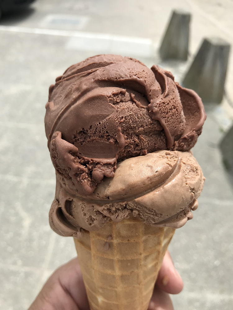
With a two-scoop waffle cone filled with chocolate and coffee ice-cream, I set off in search of acorns. Not, I hasten to add, as a garnish for my ice-cream but as indicators of the route of one of Britain’s long-distance footpaths. I was following a very small section of the South-west Cost path which runs from Poole in Dorset to Minehead in Somerset. The path, as its name suggests, follows the coast around the south-west peninsula of the British Isles.
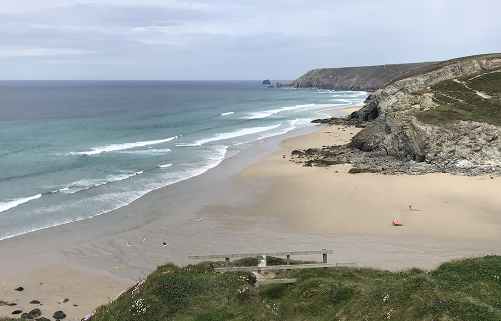
Having climbed steadily out of Porthtowan I was rewarded with a view across the bay and along the dramatic coastline towards Chapel Porth.
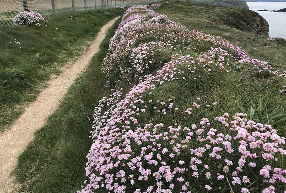
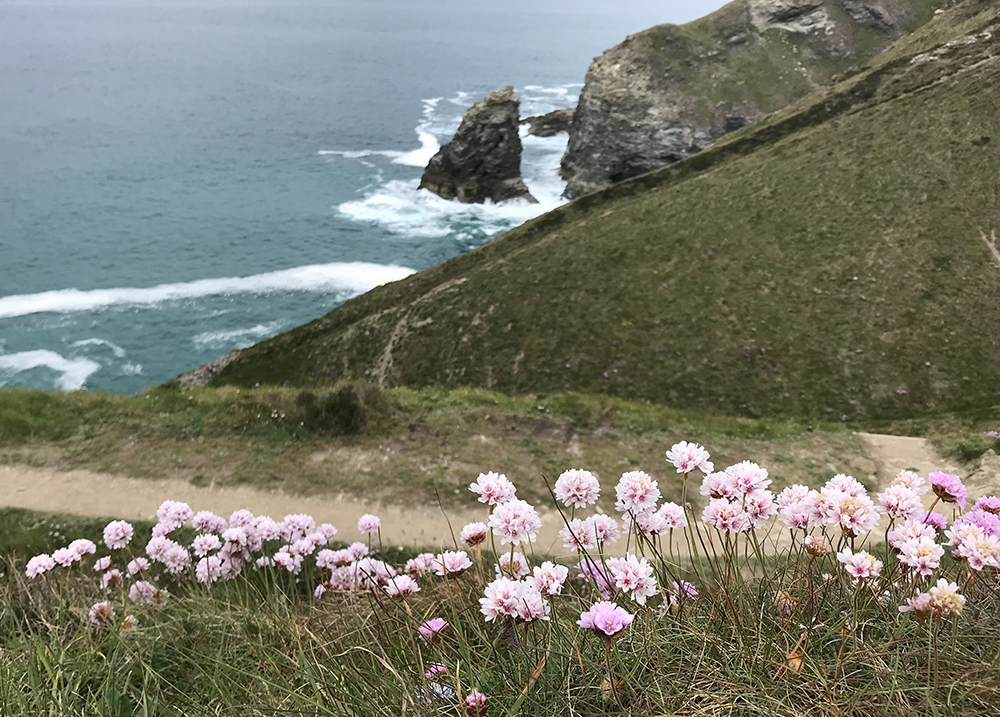
The path begins as a rough track with high Cornish banks designed to hide smugglers transporting contraband from the eagle-eyes of the law enforcing coastguards. Today they are covered in drifts of flowers, stunted heather and gorse. Being late Spring there were masses of flowers. This was to be a feature of the entire walk.
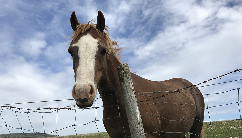
At first, there were no other hikers on the trail. Two inquisitive horses came to the fence. The track was rough and the Cornish stone walls were covered in sea thrift and myriad other wildflowers.
Soon after the path crossed heathland of stunted heather and gorse that tops the cliffs. The coastline ebbs and flows from the path as it passes above coves carved by the action of wind and sea.
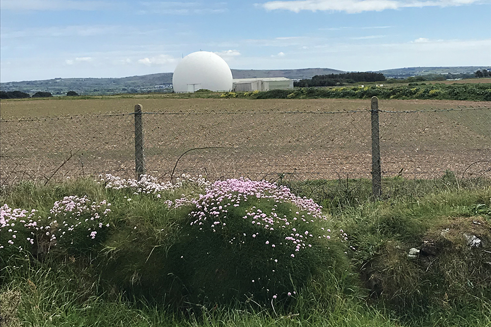
Soon though a chain link fence appears on the left with a sign ‘MOD Property Keep Out’ writ large. A quick glance at the map shows it to be a disused airfield. The airfield bit is disused, however, the large white sphere visible for miles around and the forest of radio masks indicate it is still very much in use.
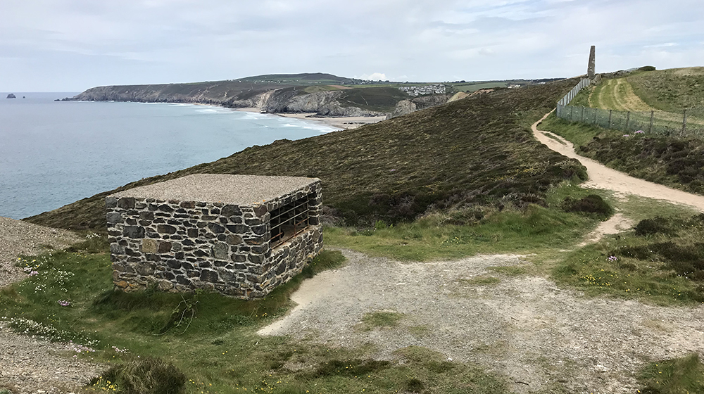
The Ministry of Defence land means you have to head along the narrow strip of public land and between the sea and the fence. In actual fact, this strip is owned and maintained by the National Trust in an effort to preserve the coastline and tin mining heritage. All along the cliff top are conical ‘cages’ and rectangular stone structures. These are not secret passages for the MOD to escape the base if it comes under attack but are mine shafts dug by Cornish tin miners. These shafts go deep underground and in some cases lead to passages that head out under the sea bed.
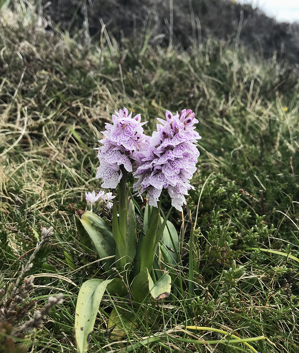
Tin mining heritage has left its mark on the landscape but nature soon reclaims it. In spring and summer, there is a profusion of flowers almost everywhere. Pink carpets of thrift are most common but look closer and you will find other flowers including orchids like those in the photograph above.
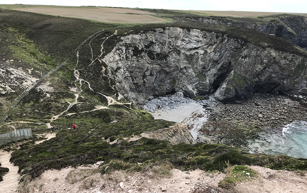
Sally’s Bottom
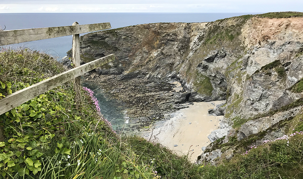
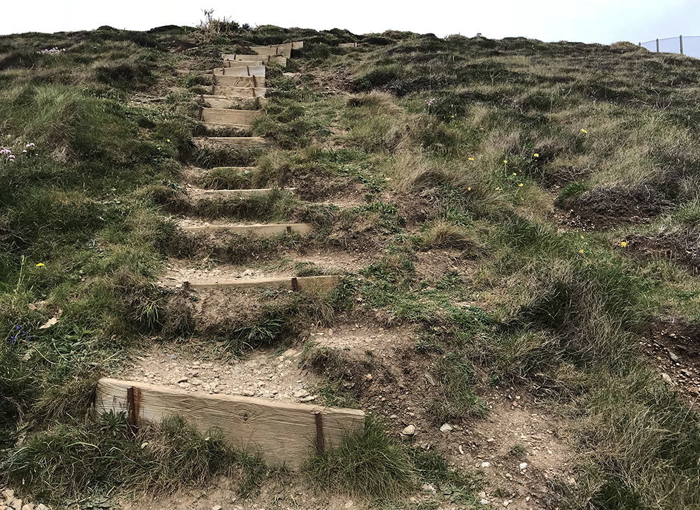
A little less than halfway to Portreath there is a steep descent to the dramatic Sally’s Bottom. A sand and rock cove beach with high cliffs, it is a great place to admire the ruggedness of the north Cornish coast from ground level. There is an equally steep climb out of the cove although rudimentary steps have been put into the slope.
The path continues along the top of the cliffs often sheltered from onshore winds by a typical Cornish earthen stone wall all topped with drifts of sea thrift interspersed with other coastal flora.
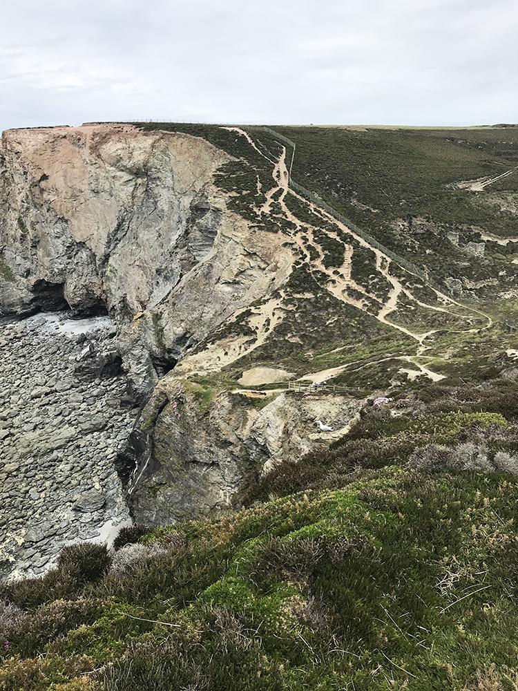
Diamond Rock
Soon Portreath Bay is visible but there is one more steep descent followed by the inevitable ascent above Diamond Rock to negotiate. Not as rugged as Sally’s Bottom the steep slopes are covered with wildflowers in the spring and summer. From here the path is gentle all the way to the Lighthouse Hill car park.
At the time of writing the path follows the road down into Portreath because of landslips that have made the original path dangerous. However, Lighthouse Hill can still be reached from a signposted footpath further down the road.
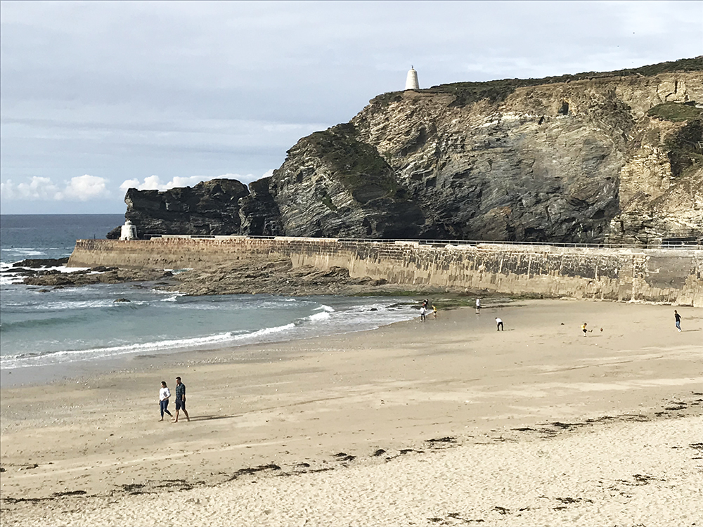
Portreath
For that second treat, you will have to skirt around long and narrow Portreath Harbour to reach the beach and The Hub. Just back from the beach and right by the bridge crossing the small stream, The Hub (www.thehubportreath.com) is a cycle hire centre with a first class coffee shop that serves the most amazing cream tea. Warm scones, strawberry jam and clotted cream are served with a reminder, on a miniature blackboard, that you are in Cornwall and that it is ‘jam first’.
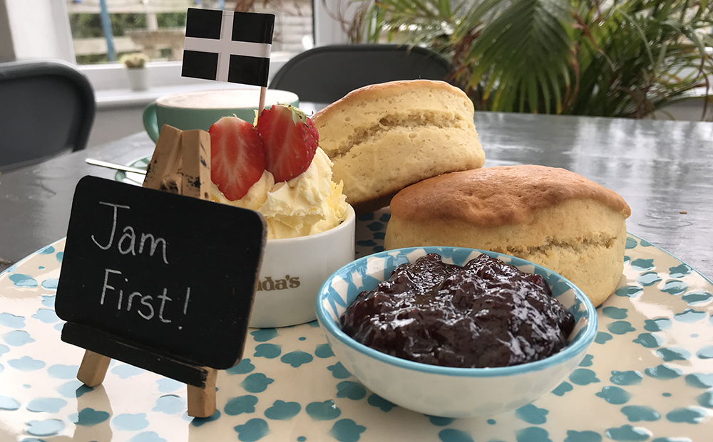
I like to think of myself as a cream tea connoisseur and the cream tea served at The Hub in Portreath is the best I have had anywhere.
What a perfect way to end a hike along the coast.
[amazon_link asins=’0143134116′ template=’ProductAd’ store=’travelu-21′ marketplace=’UK’ link_id=’24cc2847-28b7-4a63-b87f-2bbc28d2e543′]